
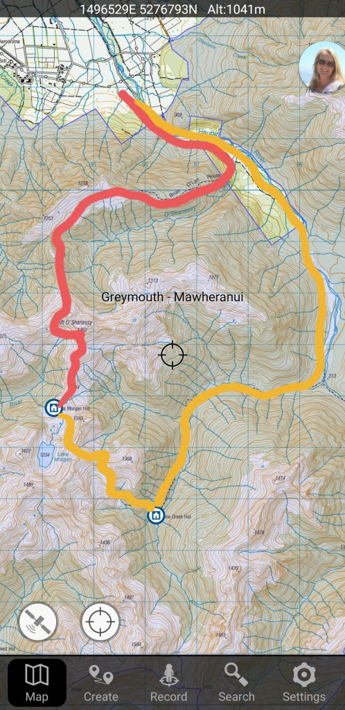
Mt O’Shanessy is marked on the map at 1462; not that high, objectively, even when considering that we were starting from only 200m above sea level. Carrie looked at trip reports from Remote Huts and DOC, and we estimated that the route would take us 6ish hours on the first day (pink line) and maybe a bit longer on the second day (yellow line).
